The 8 Best Hikes in Sedona; Plus Tips on Parking & More
Sedona is one of my absolute favorite places to visit in Arizona — and honestly, one of my favorite places in the world to hike. I first explored these trails on my honeymoon and left with a serious case of "I need to come back." As a travel advisor, I help clients plan Sedona trips regularly, which means I've had plenty of opportunity to research, refine, and live vicariously through these trails in the meantime. These are the 8 hikes I recommend most — whether you're a first-timer looking for a scenic walk or a seasoned hiker ready for a scramble.
Related Post: The Ultimate Arizona Road Trip
This post contains affiliate links. I may earn a small commission if you shop through them, at no extra cost to you.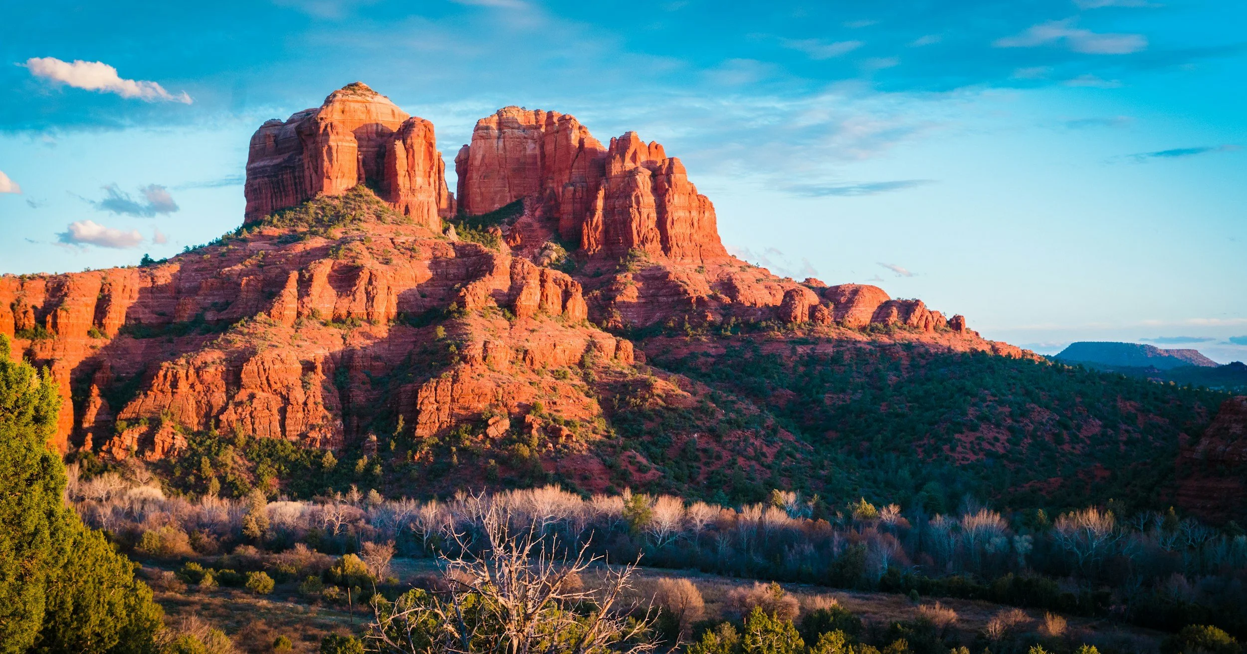
The Best Trails in Sedona
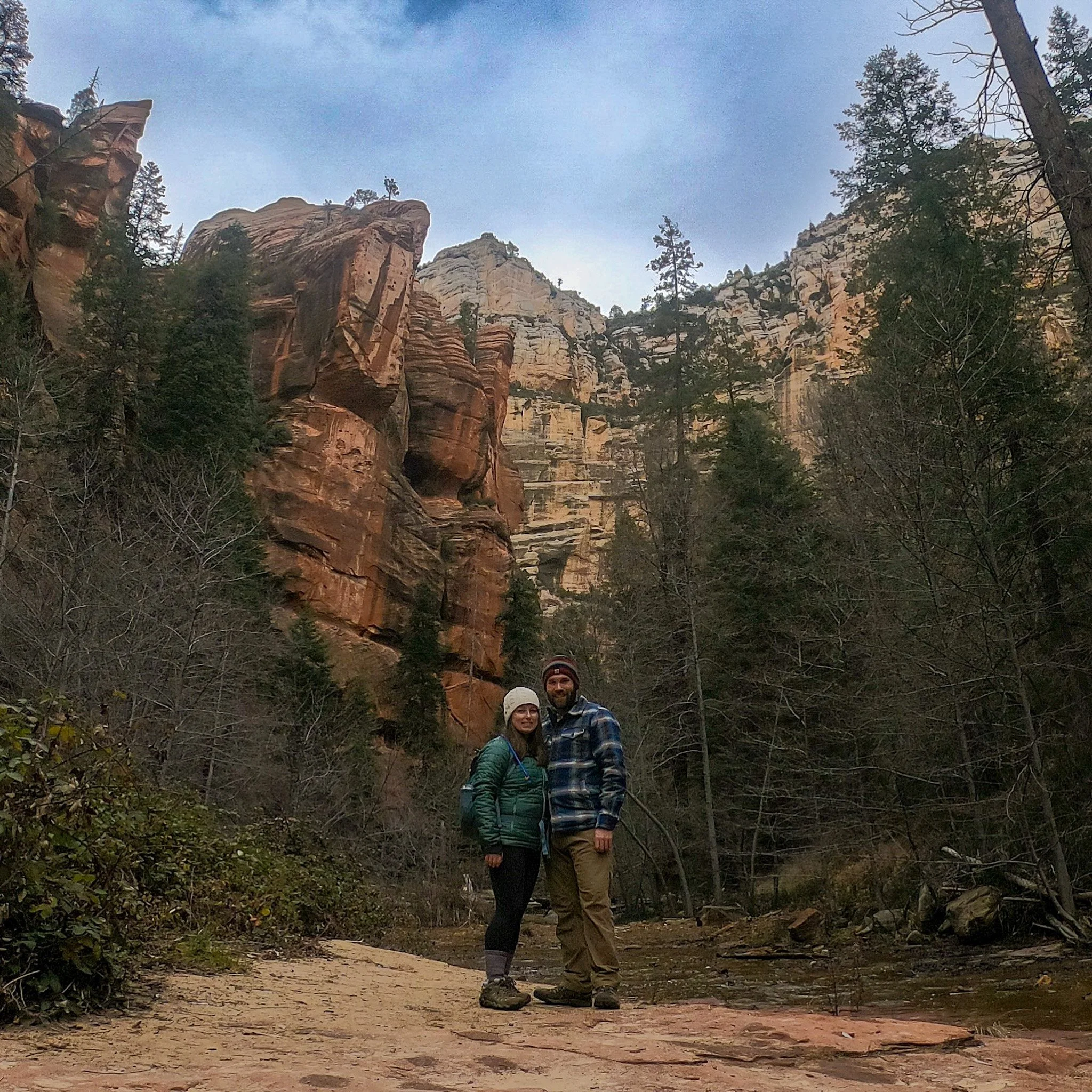
Fay Canyon - Sedona, AZ
Fay Canyon Trail
2.1 mi out & back trail
Rated Moderate on AllTrails
Fay Canyon offers breathtaking views of Sedona’s unique rock formations. While rated as moderate, the trail is generally flat, with some rock scrambling. This hike is a popular choice for families and those looking to get away from the crowds at some of the more “instagrammable” trails in the area. This was hands down one of my favorite hikes on our last trip to Sedona.
Bell Rock Trail
0.8 mi out & back trail
Rated Moderate on AllTrails
Bell Rock is one of the ‘vortex’ locations Sedona is known for, and also one of the easiest to access - with the main attraction just a short distance from the trailhead. The walk to the base of the rock is under a half mile and pretty flat. Once you climb up onto the rock (no rock climbing equipment required), find a place away from the crowds to take a seat and see if you can sense the energy these rocks are known for. If you’re expecting to feel something resembling low level electrocution, you might be disappointed but I still found this to be a great place to meditate and reflect.
Cathedral Rock Trail
1.2 mi out & back trail
Rated Moderate on AllTrails
Cathedral Rock is consistently one of the most-photographed spots in all of Arizona — it's on every "best of Sedona" list for good reason. The short but challenging climb to the saddle rewards hikers with stunning views of Sedona's famous red rock landscape, and as one of the area's recognized vortex sites, it's also a popular destination for those seeking a deeper spiritual connection. I recommend building in extra time at the saddle; most hikers rush to the top and back, but the views reward anyone willing to linger.
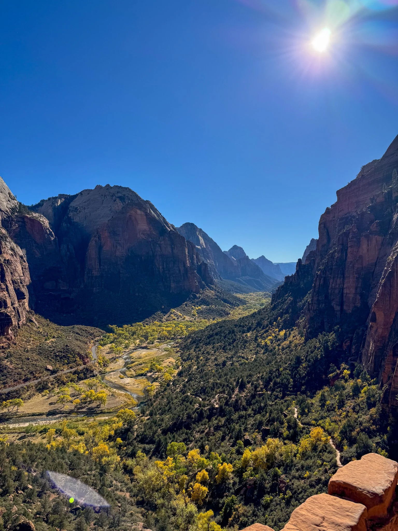
Oak Creek Canyon, West Fork Trail
Oak Creek Canyon, West Fork Trail
6.5 mi out & back trail
Rated Moderate on AllTrails
The West Fork is one of the most unique hikes in Sedona - a completely different landscape from what most of the other trails have to offer. Where most Sedona trails put you on top of the landscape looking out, West Fork puts you inside it — canyon walls rising on both sides, creek crossings underfoot, and a canopy overhead that shifts with the seasons. The 13 stream crossings make it feel more like an adventure than a walk, and the trail naturally ends when the canyon narrows to a close. If 6.5 miles feels like too much, even the first mile from the trailhead is worth the walk.
Devils’ Bridge
3.9 miles out & back trail
Rated Moderate on AllTrails
Devil's Bridge is one of the most popular hikes in all of Sedona, and for good reason — the trail meanders through desert washes to a rock scramble leading to the ultimate payoff: a natural sandstone arch carved into the landscape over thousands of years. The elevation gain is moderate enough that most hikers can manage it comfortably, but the panoramic views from the top make it feel like a much bigger accomplishment. The parking area fills up extremely fast, so early morning arrival is your best bet for securing a spot. Fair warning: the arch itself gets a line of people waiting for their shot and it can move slowly. If beating crowds is a priority, consider whether the wait is worth it for you
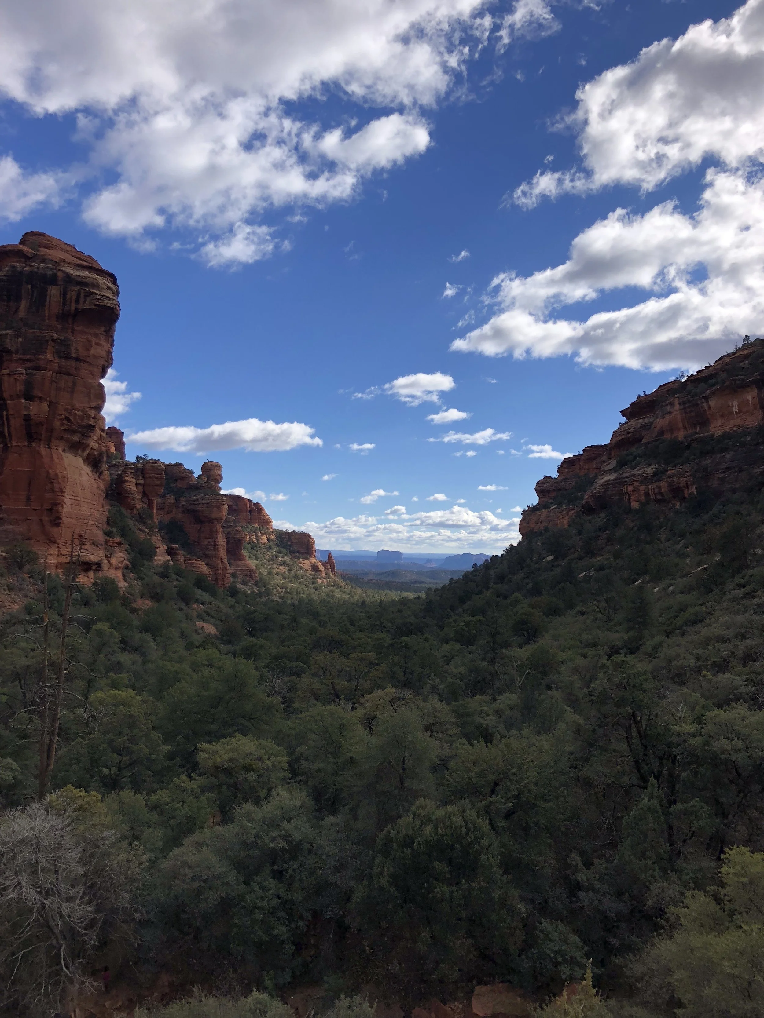
Boynton Canyon Trail
7.2 mi out & back trail
Rated Moderate on AllTrails
Boynton Canyon is the hike I recommend when someone tells me they want something that feels less crowded and more immersive. As a well-known vortex site considered sacred by some Indigenous groups, there's a distinct energy here that sets it apart from Sedona's more open red rock trails — the canyon walls close in around you, the shade deepens, and the lush mix of Arizona cypress and manzanita makes it feel like a completely different landscape. Keep an eye out for mule deer, especially in the quieter morning hours.
The trail also rewards those who pay attention to the spurs. The Subway Cave is located just off the main trail and easy to miss if you're moving fast. More significant is the Birthing Cave — a natural alcove in the red rock that holds deep spiritual significance for the Yavapai people and offers beautiful views of the canyon below. It's worth the short detour. If you want to extend your day, the Long Canyon Trailhead is located nearby and makes a natural second hike.
Seven Sacred Pools, Soldiers Pass Trail
Soldier Pass Trail
3 mi out & back trail
Rated Moderate on AllTrails
This hike was one of my favorites while visiting Sedona. This one hike offers a sampler of all the best things of Sedona - if you can only do one hike on your visit, this is it. First up, you’ll pass the “Seven Sacred Pools” - natural pools that have been carved into the sandstone, with stunning red rock crags in the background. As you continue on, you’ll come to “Devil’s Kitchen” - a sinkhole formed by the collapse of underground caverns. Finally, you’ll reach the Soldiers Pass cave formed by arches and a traversable ledge. This trail truly has a little bit of everything all rolling into one hike.
Airport Loop Trail
3.3 mi loop trail
Rated Moderate on AllTrails
This loop trail encircles the upper slope of Airport Mesa. Sitting at 4,827 feet, the mesa sits above much of Sedona providing hikers on this trail panoramic views of some the most famous red rock formations in the area including Cathedral Rock, Bell Rock and Courthouse butte just to name a few.
PRO TIP - hit this trail about an hour before sunset to take in all of the golden hour beauty of the vibrant red rock landscape.
Top Sedona Hiking Tips
Plan Ahead with these helpful tips:
Sedona's trails sit within the Coconino National Forest, and while the area is well-traveled, it's still a wilderness environment. Most of the hikes on this list are suitable for a day hike with moderate fitness — but elevation gain and exposure varies considerably between trails. Know your limits and choose accordingly!
Download AllTrails - The AllTrails app is a GPS app built for hiking. You can use it to discover and learn about nearby trails including their length and difficulty. Additionally, you can find reviews from other recent hikers which may alert you to current trail conditions and other considerations. The navigation feature on the AllTrails app allows you to track your hike to help minimize your chances of getting lost, however do keep in mind that cell service can be spotty in remote areas so always plan ahead and know your route.
Purchase a Red Rock Pass — Many hiking trails in the Sedona area require a Red Rock Pass to use the parking area at the trailhead. Day passes are $5 per vehicle and can be purchased at trailhead kiosks, though buying in advance online is a good idea to save time. Note that some trailheads have small parking lots that fill up fast, especially on weekends — arriving early morning is the best way to guarantee a spot. A weekly pass ($15) is worth the extra cost if you're spending several days hiking.
Know what to bring with you and pack extra in case you are out longer than you expect. Essentials include a day pack with plenty of water, food, sunscreen and/or other sun protection items. Additionally, you’ll want a good pair of sturdy hiking shoes.
Consider taking the shuttle - Some of the more popular trailheads have small parking lots. Sedona offers a complimentary shuttle service that runs Thursday-Sunday throughout the year. For route information and timetables, click here.
About Sedona
Location:
Sedona is located about 2 hours north of Phoenix, 30 minutes from Flagstaff, and 90 minutes from the Grand Canyon — making it an ideal stop on any Southwest national parks road trip. It is known for its stunning red rock formations, creating an awe-inspiring landscape for buttes and canyons that draw visitors from around the globe. Its mild climate and “vortexes” have contributed to Sedona’s reputation as a haven for outdoor recreation and those seeking a spiritual connection.
When to Visit:
Honestly, Sedona is pretty incredible in any season and all of these hikes are beautiful year-round. Here’s what you can expect:
Spring (March - May):
Weather: Mid-60s to low 80’s
Experience: This is a popular time, so expect more crowds. Depending on winter rains, this is a great time to potentially see wildflowers in bloom.
Summer (June - August):
Weather: Temperatures reaching the 90s. This is also monsoon season, afternoon thunderstorms are most likely.
Experience: Great for early morning or evening hikes to beat the heat and rain. Fewer crowds compared to spring and fall.
Fall (September - November):
Weather: Mid-60s to low 80’s
Experience: This is another popular time of year, so expect crowds. The tradeoff is the opportunity to see fall foliage against a backdrop of red rocks.
Winter (December-February):
Weather: Daytime temperatures in the 50s-60s with the potential for snowfall. Chilly evenings.
Experience: Fewer crowds. I LOVE a hike in 50 - 60 degree weather, this is easily my favorite time of year to visit!
Getting to Sedona, AZ
✈️ Flying:
Most visitors opt to fly into Phoenix Sky Harbor Airport (PHX). At just over a 2-hour drive, it is the closest international airport. PHX is an American Airlines hub and offers direct flights from most major airports in the US.
Flagstaff Airport (FLG) is the closest small commercial airport to Sedona, and offers direct flights from Phoenix, Denver and Dallas. This airport is located about a 40-minute, scenic drive from Sedona.
🚗 Rental Car:
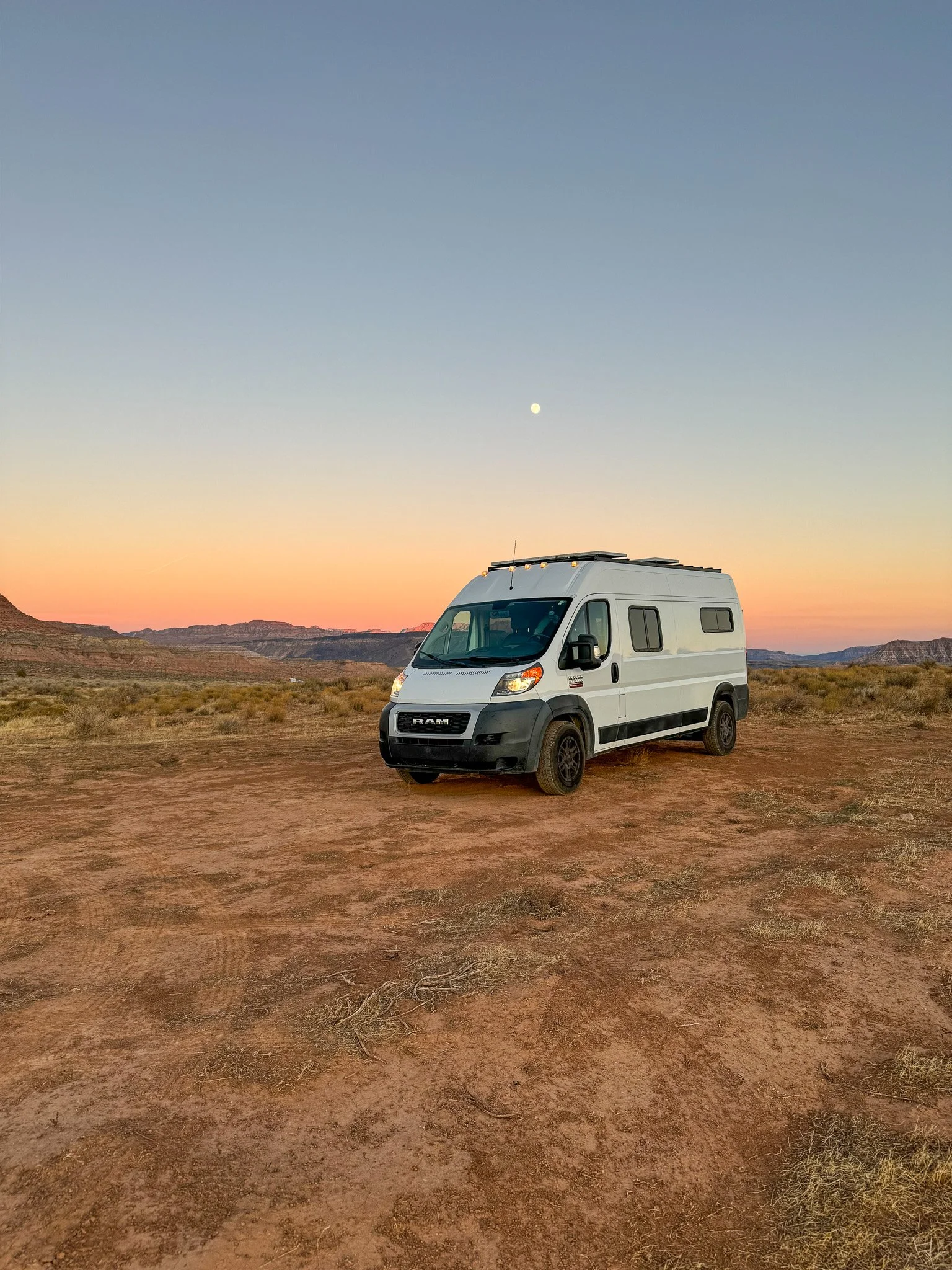
Do you need a rental car when visiting Sedona? I would highly recommend it! Not only will it be your best bet from getting to Sedona from your preferred airport, the town itself is fairly spread out. Additionally, most trailheads are located in areas outside of the city proper, requiring a vehicle to easily access them. Trying to Uber to/from these locations wouldn’t be advisable.
🏨 Where to Stay in Sedona
Whether your are looking for a luxurious wellness retreat or exploring on a budget, Sedona has options at every price point.
💸💸💸💸 Enchantment
💸💸💸💸 Ambiente
Want more tips, personalized recommendations and access to perks such as complimentary upgrades and spa credits?
I would love to help you book your Arizona getaway!
Hi, I’m Jess
I’m here to help you plan epic adventures. If you’re looking for authentic travel guides that mix luxe lodging and incredible dining with out of this world hikes and adventures, you’re in the right place.