Guide to Hiking in Cabo San Lucas — Top Trails
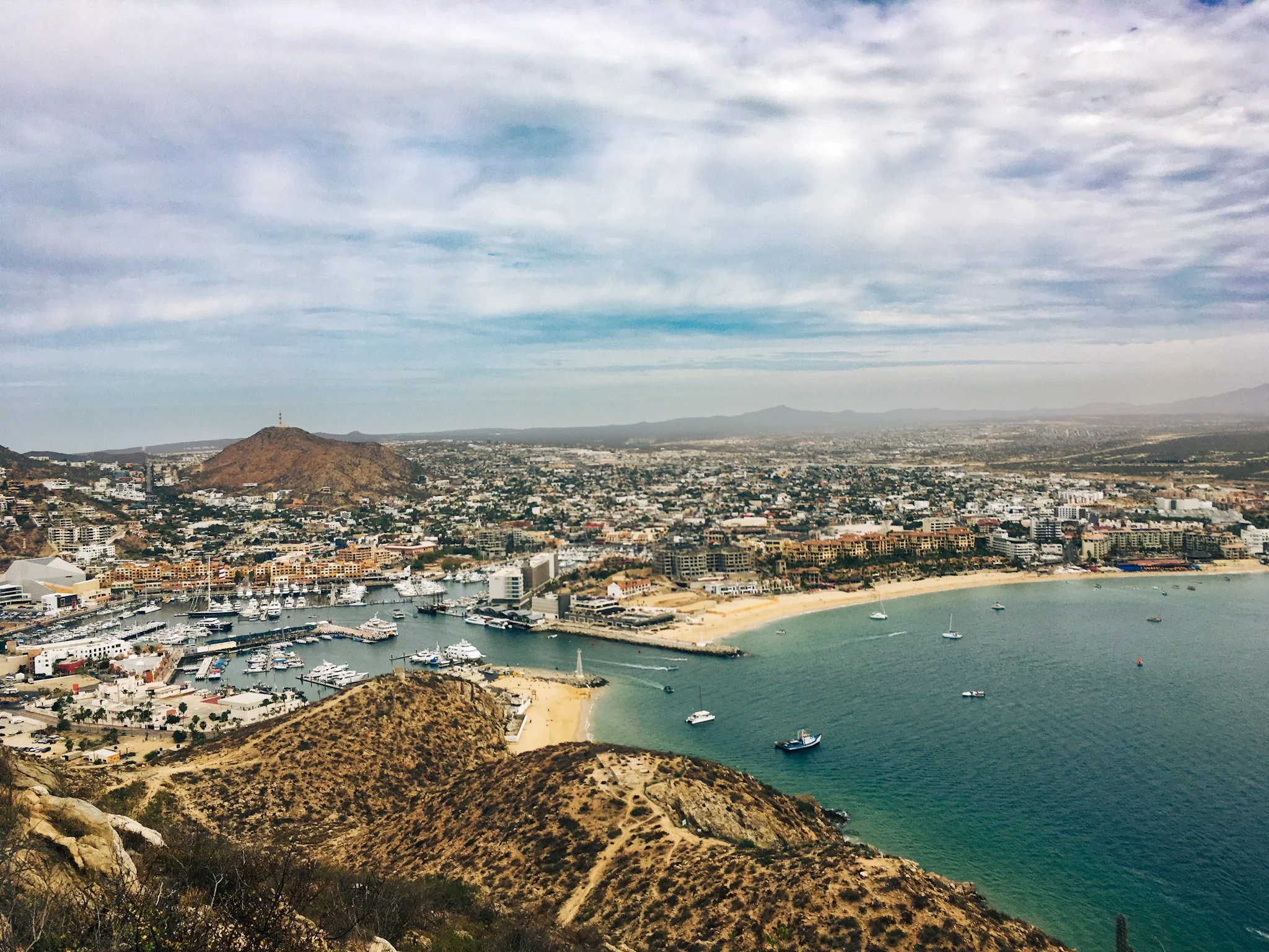
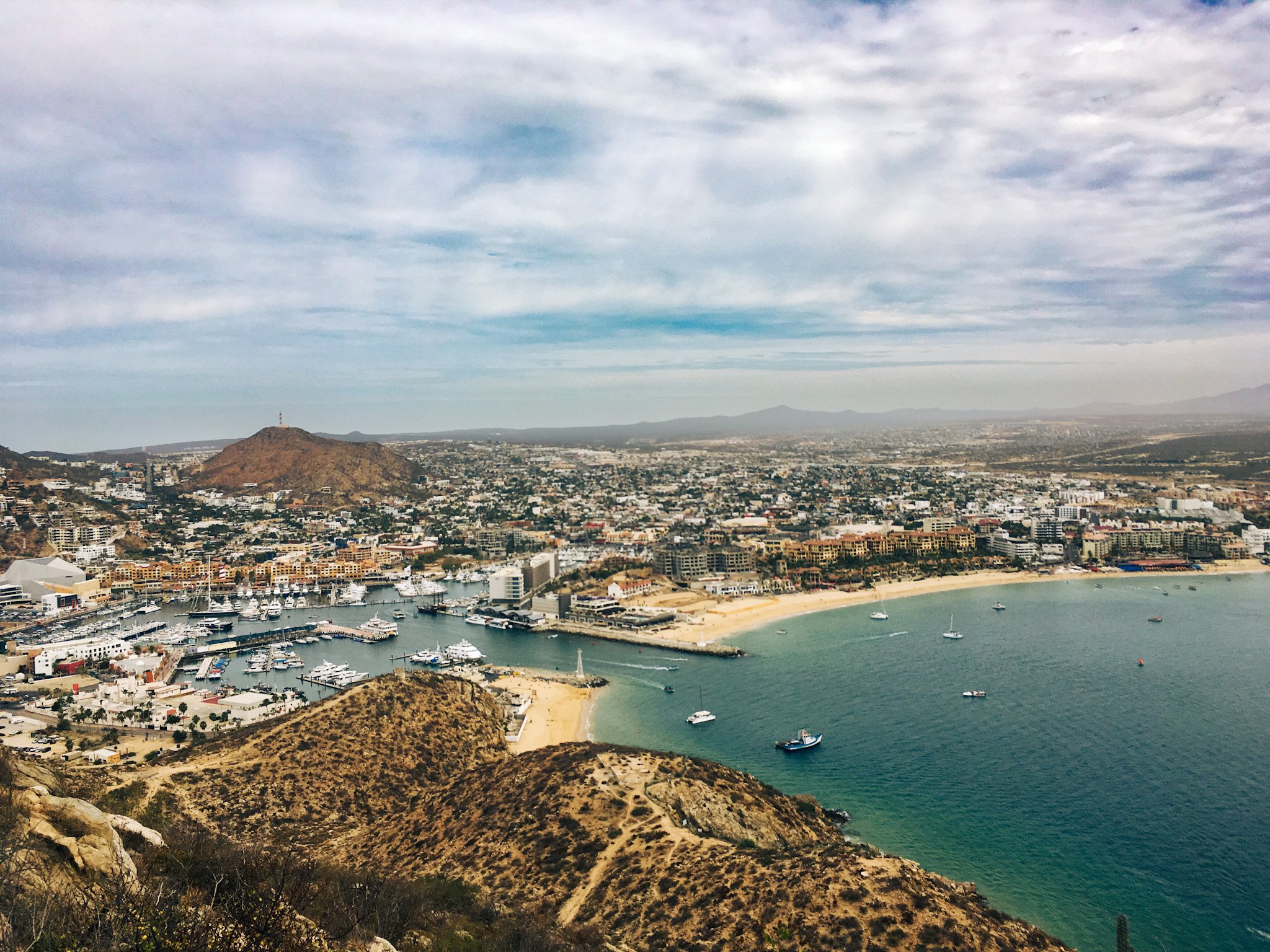
View from Mt. Solmar
One of the things that gets overlooked when vacationers are planning a trip to Cabo San Lucas is that it isn't just a beach town — it's a desert playground where rugged terrain, sun-bleached cactus fields, and rocky sea cliffs meet the Pacific Ocean on one side and the Sea of Cortez on the other. It's one of the things that keeps bringing us back to Baja (almost annually since 2018!)
Adventures can range from snorkeling with sea lions to trekking through stunning desert arroyos. From short urban hikes you can knock out before breakfast to a full day trip deep into Sierra de la Laguna, there's a trail here for every skill level. Whether you're staying downtown, out in Pedregal, or basing yourself closer to San José del Cabo, this guide rounds up the best hiking trails in and around Cabo San Lucas.
This post contains affiliate links. I may earn a small commission if you shop through them, at no extra cost to you.
Downtown Cabo San Lucas & Pedregal
The trails closest to downtown are the most convenient option if you don't have a rental car — most are walkable or a short rideshare from the marina, and they're a great way to get a scenic hike in without giving up a full day of your trip.
Mt. Solmar Trail (Cerro del Vigía)
Mt. Solmar — also called Cerro del Vigía — is the most talked-about hike in Cabo San Lucas, and the experience is unlike anything else on this list. The trail sits on private property behind a dog training center near the marina, and it's a steep half-mile scramble that gains nearly 400 feet, leading to 360-degree views of Cabo: the marina, Medano Beach, and the exact spot where the Pacific meets the Sea of Cortez. Because this hike is on private property, it can only be done with a guide. There's no way to book ahead — you simply show up before the gate opens and join the guide for the climb, often trailed by a pack of the kennel's own dogs. It's a free hike, but tip boxes are set out for your guide, Enrique, and I'd encourage you to use them.
While I typically don't prefer a guided hike, I actually love that this one is guided. The first time we hiked it in 2018, they weren't limiting access and we ended up off-trail, rock scrambling up the side of the mountain (which I absolutely would not recommend). Now, with Enrique's guidance, there's no doubt you're on the right path. He allows you ample time at the summit to take in the views before descending back to the trailhead.
Distance: 1 mile | Out & Back
AllTrails Difficulty: Hard (short, but steep with loose rock), if you have issues with height or exposure, this hike may not be for you.
Elevation Gain: 380 ft
Estimated Time: 2 hours
Dog Friendly: Not for your own pets — this is private property with a guided group, though you'll likely be joined by some of the resident kennel dogs
Parking: None at the trailhead. This is a walk-up or rideshare destination only — it's about a 20-minute walk from the marina to the meeting point.
Pro tip: Hikes are usually hosted at 8 a.m. Sunday-Friday. Enrique sometimes changes the days and times hikes are offered, so check the "Ascenso al Cerro del Vigía" Facebook page for the latest schedule before you go. Bring cash for a tip.
Cerro de la Z
Cerro de la Z (also called Cerro Prieto) is the classic urban hike in Cabo San Lucas. The route climbs through the cobbled streets of Pedregal before turning onto a dirt road that switchbacks up to the summit at 245 meters, where an old (closed-to-the-public) observatory marks the top. From there, you get a 360-degree panoramic view of the marina, the bay, and the mountains inland — one of the best panoramic views in the city, and worth doing at sunrise or sunset when the light is best.
Distance: 1.3 miles, depending on your starting point | Out & Back
Elevation Gain: 406 ft
Estimated Time: Less than 1 hour
Dog Friendly: Yes, on leash
Parking: Street parking in Pedregal near the trailhead off Via La Paloma; free but limited. Reaching the trailhead on foot from downtown Cabo is manageable — there are sidewalks all the way until the dirt road.
Pro tip: There's no shade on this trail, so avoid the peak heat of midday. Bring plenty of water and sunscreen, and aim for an early start or an evening hike closer to sunset.
Cerro de las Torres
Cerro de las Torres is a short but steady desert climb up a dirt and gravel road, popular with trail runners, mountain bikers, and off-roaders as well as hikers. There's no shade here and the terrain is classic Baja California Sur desert — cardón cacti, torote trees, and the occasional lizard darting across the path — but the payoff is a sweeping panoramic view of San Lucas Bay from the peak of Cerro Colorado.
Distance: 3 miles | Out & Back
Dog Friendly: Yes
Elevation Gain: 797 ft
Estimated Time: 2 hours
Parking: There is no dedicated parking, but spaces can be found on the streets around the trailhead.
Pro tip: This is a great late afternoon hike if you time it right — the desert light near sunset is spectacular, and temperatures are much more manageable than midday.
Sierra de la Laguna & Fox Canyon
For a completely different kind of hike, head inland to the Sierra de la Laguna Biosphere Reserve — a UNESCO-protected mountain range roughly 1–2 hours from Cabo San Lucas depending on the trailhead. This is where the desert climate gives way to lush canyons, natural pools, and a noticeably cooler microclimate.
Cañón de la Zorra (Fox Canyon / Cascada Sol de Mayo)
Fox Canyon is the most popular day-trip hike out of Cabo San Lucas — it's at the top of my list for my next trip to Baja and one I've heard raved about by every local guide and traveler I've talked to. A quick note before you go: Fox Canyon, Cañón de la Zorra, and Cascada Sol de Mayo are all the same place, just different names for one waterfall inside the privately owned Rancho Ecológico Sol de Mayo near the town of Santiago. The walk to the waterfall itself is short but requires a rock scramble descending into the canyon where you're welcomed by a 40-foot waterfall and a clear swimming pool below it. If you want more of a hike, continue up the trail along the river into the canyon. There is at least one river crossing, so plan accordingly with your footwear!
Distance: About 2.2 miles, including hiking beyond the falls | Out & Back
AllTrails Difficulty: Moderate (short, but steep in a few spots with some rope-assisted sections near the pools)
Elevation Gain: 357 ft
Estimated Time: Varies based on how long you spend at the falls
Dog Friendly: No
Parking: Available at the ranch entrance; a per-person entrance fee applies (250 pesos, cash only).
Pro tip: Bring a swimsuit and water shoes — you'll want to get in the water. The drive from Cabo San Lucas takes about an hour to an hour and a half, and the last stretch is a rough dirt road, so go slow if you're self-driving. Bonus tip: Just about 20 minutes from Fox Canyon, you can find Santa Rita Hot Springs where you can soak after the hike.
Sierra de la Laguna Trail
If Fox Canyon feels too easy, the Sierra de la Laguna Trail kicks up the difficulty to another level — a challenging hike into the biosphere reserve's oak-and-pine highlands, home to hummingbirds and cacti found nowhere else on the peninsula. The trailhead is accessed via a rough 19-kilometer dirt road (about 40 minutes). You'll want a high clearance vehicle if you're planning to reach this trail in your own rental car.
Distance: 7.5 miles | Out & Back
Elevation Gain: 1,706 ft
Estimated Time: 4-5 hours
Dog Friendly: Not recommended for this terrain
Parking: Available at the trailhead (marked "El Portón, Sierra La Laguna" on Google Maps), about 45 minutes northeast of Todos Santos. The property owner collects an entrance fee plus a separate parking fee, cash only — bring small bills.
Pro tip: There's no shade anywhere on this trail. Start early, pack more water than you think you'll need, and bring snacks with electrolytes for the return trip.
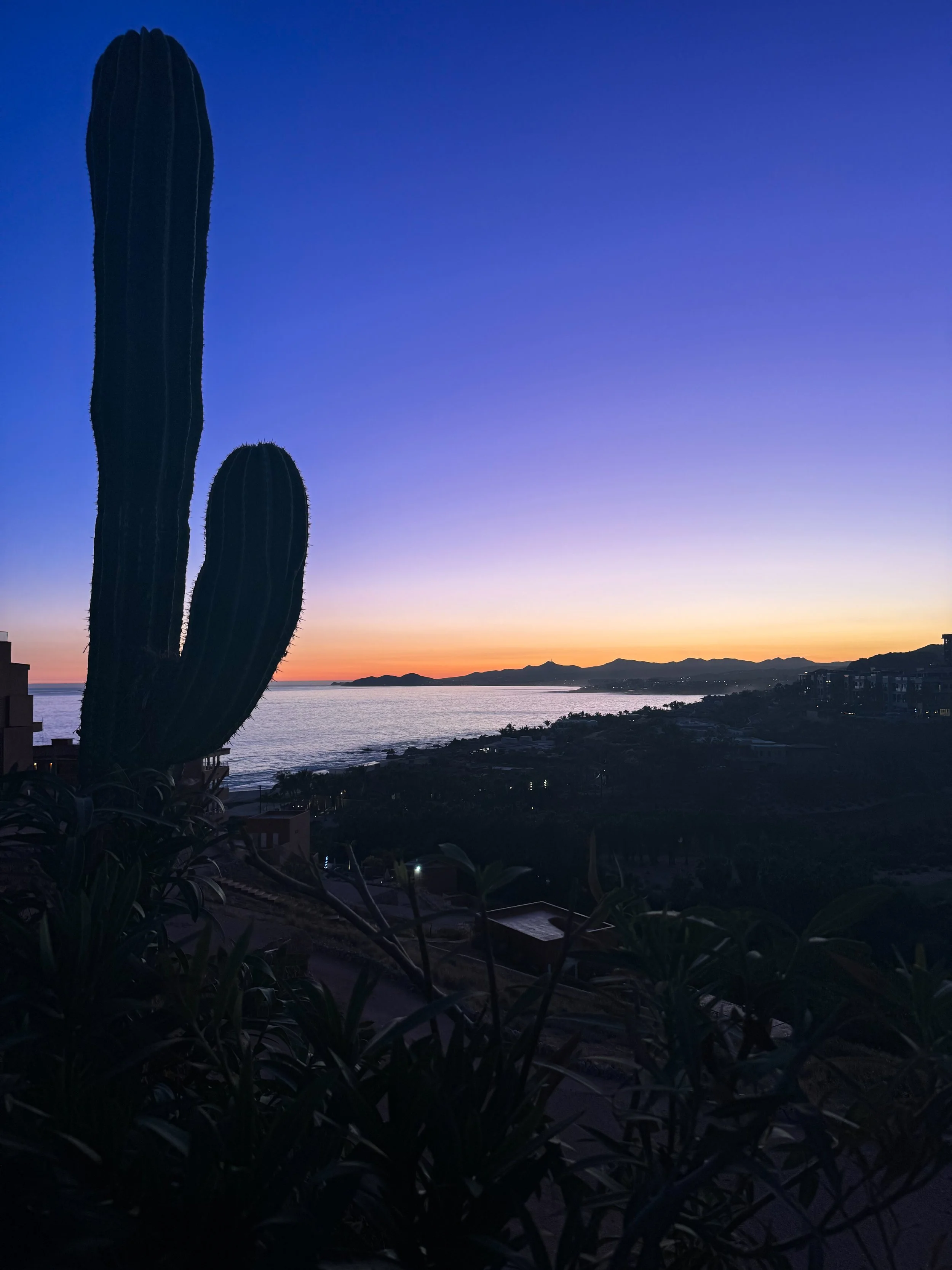
View from Punta Lobos
Todos Santos & Cabo Pulmo
If you have plenty of time and want to turn a hike into a full day trip, both Todos Santos and Cabo Pulmo are worth the drive.
Punta Lobos
This hike is my favorite spot to take in a sunset in Los Cabos. Just outside of Todos Santos, Punta Lobos is a scenic hike along Pacific Ocean bluffs, with sweeping ocean views the entire way. The trail starts behind a small yellow chapel on the beach, climbs to a lookout point, and can continue down to the sand toward town — it's popular with birders as well as hikers, and it's also a great spot to watch local fishermen bring in the day's catch by hand. If you visit between December and April, keep an eye on the water — this stretch of coast is a good vantage point for spotting migrating whales.
Distance: 2.5–4 miles depending on how far you continue | Out & Back
AllTrails Difficulty: Easy — but if you have a fear of heights or exposure it may not be for you.
Elevation Gain: 209 ft
Estimated Time: 1 hour
Dog Friendly: Yes, and may be off-leash in some areas
Parking: Free lot near the Punta Lobos beach access.
Pro tip: Late afternoon is the best time to catch the fishing boats coming in, and it also happens to be prime time for photos with the golden coastal light. If you plan to hike at sunset, be sure to bring a headlamp.
Circuito Cabo Pulmo
Cabo Pulmo National Park is better known for its incredible reef and marine life than its trails, but the hills above the beach offer a rewarding loop hike with views over the entire bay and national marine park below.
Distance: 6 miles | Loop
Elevation Gain: 813 ft
Estimated Time: 2-3 hours
Dog Friendly: Yes
Parking: Just inside the park gate near the tennis courts; free.
Pro tip: Combine this hike with an afternoon of snorkeling — Cabo Pulmo is one of the best-preserved reef systems in the Sea of Cortez, and the marine life alone makes the roughly two-hour drive worth it. The last stretch of road is unpaved, so budget extra time.
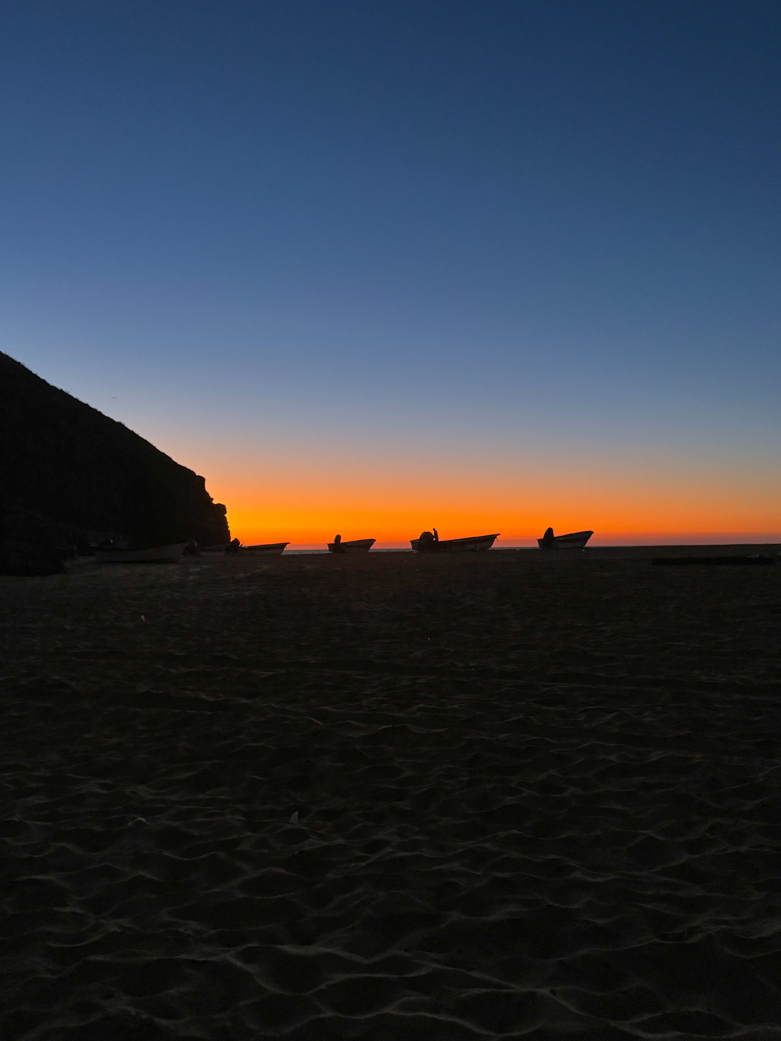
Beach Below Punta Lobos
FAQs: Hiking in Cabo San Lucas
What's the best time of year to hike in Cabo San Lucas?
Winter and early spring (November–April) are the best months — daytime temperatures are milder and the desert climate is far more comfortable for longer hikes. Summer months (June–September) bring intense heat and higher humidity, so if you're hiking then, stick to a very early start or save your hike for the evening. This is also when the rainy season can affect canyon and river trails.
What should I pack for a hike in Cabo?
Wide-brim hat and sunglasses — there's little to no shade on most trails here
Sturdy hiking shoes — the rocky terrain and loose gravel call for real tread; this isn't somewhere to hike in flip-flops
Plenty of sunscreen — reapply often; the desert sun is intense even in cooler months
A large water bottle or hydration pack — plan on at least 2 liters for anything over an hour, more for the longer inland hikes
A light, packable layer — mornings can be cool, especially up in Sierra de la Laguna
A basic first aid kit and a downloaded offline trail map, since cell service is unreliable outside the city
Cash — several trailheads, including Fox Canyon and Sierra de la Laguna, charge entrance fees that can only be paid in pesos
Do I need a guide?
For most of the short hikes around downtown and Pedregal, no — these trails are well-traveled and easy to follow on your own. The Mt. Solmar hike is the exception: it's on private property and can only be done with the guide who runs it. For Sierra de la Laguna and Fox Canyon, a guided tour isn't required but is worth considering, especially on your first visit — a local guide knows the terrain, the water crossings, and the best swimming spots, and can help you avoid getting lost in fairly remote desert conditions.
Are these hikes dog-friendly?
Most of the urban trails are dog-friendly on leash, as is the loop at Cabo Pulmo. Mt. Solmar and Fox Canyon don't allow visitor dogs, and the longer Sierra de la Laguna routes aren't a good fit for most pets given the terrain and distance.
Is there an entrance fee?
Some trailheads — particularly Fox Canyon and the Sierra de la Laguna trailhead — charge a small per-person fee, sometimes with a separate parking fee, paid in cash. Most of the in-town trails around Cabo San Lucas and San José del Cabo are free.
What wildlife might I see?
Expect lizards, hawks, and desert cottontails on the drier trails close to town. Out in Sierra de la Laguna, keep an eye out for hummingbirds and other unique flora and fauna found nowhere else in Baja, plus a wider range of birdlife than you'll see along the coast. Along the Punta Lobos bluffs in winter, watch the water for migrating whales.
Have a favorite hike near Cabo San Lucas that didn't make the list? Drop it in the comments — I'd love to hear about it.
Want more tips, personalized recommendations and access to perks such as complimentary upgrades and spa credits?
I would love to help you book your Cabo getaway!
Hi, I’m Jess
I’m here to help you plan epic adventures. If you’re looking for authentic travel guides that mix luxe lodging and incredible dining with out of this world hikes and adventures, you’re in the right place.




My favorite petite jackets - including fleeces and rain jackets